Iran Classic

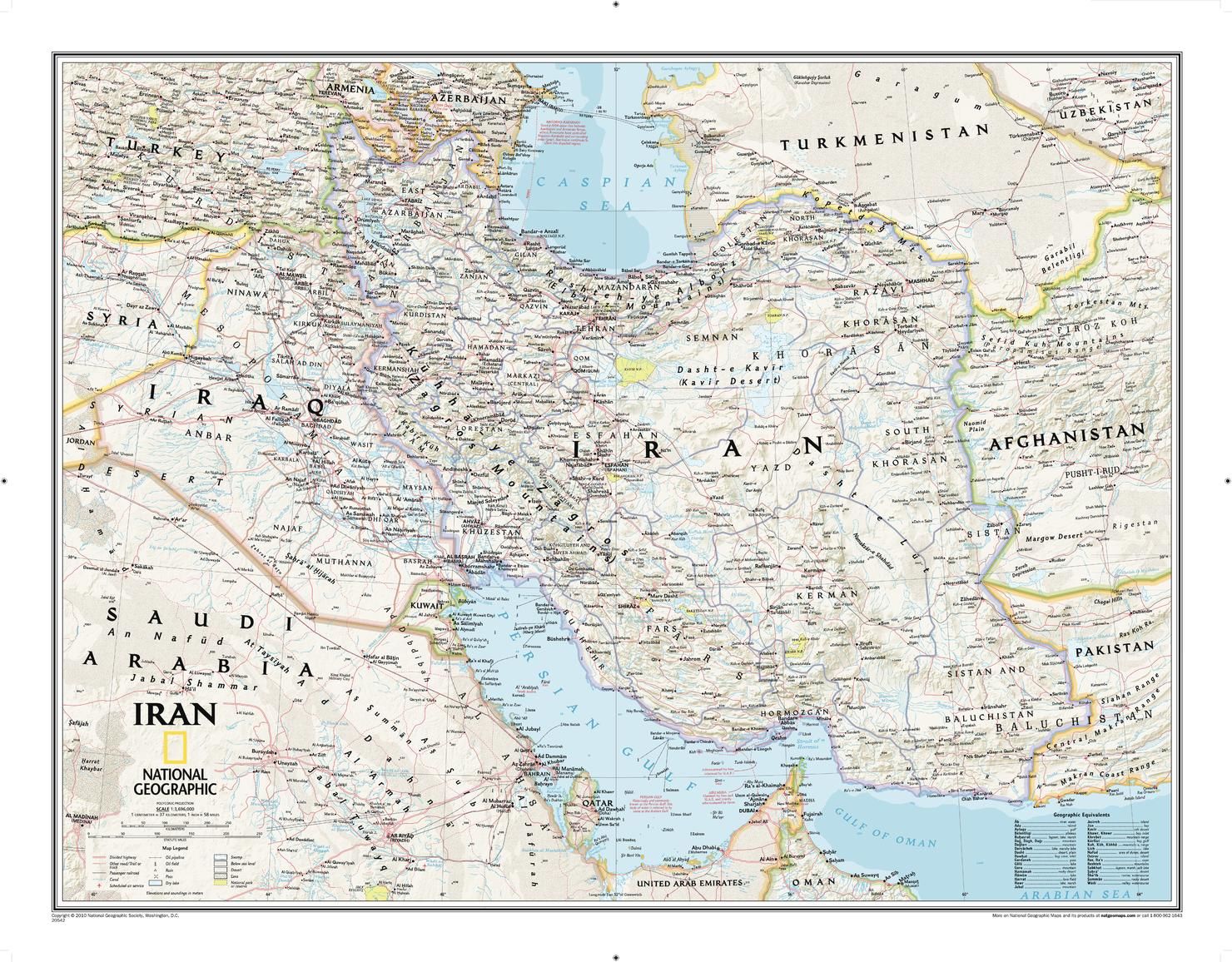
Wallmap of Iran, features the classic National Geographic reference styling. Includes hundreds of place names, accurate political boundaries, national parks, archeological sites, and major infrastructure networks such as roads, canals, ferry routes, and railroads. Irans diverse terrain is detailed through accurate shaded relief, coastal bathymetry, and symbolism for water features and other landforms. Includes table of geographic equivalents translated into English. Elevations of major peaks and depth soundings are expressed in meters. In addition, the bordering countries of Iraq, Turkey, Armenia, Azerbaijan, Turkmenistan, Afghanistan, and Pakistan are shown as well as outlying countries including Syria, Uzbekistan, United Arab Emirates, Oman, Kuwait, and Saudi Arabia.
| Brand | NATIONAL GEOGRAPHIC |
|---|---|
| Country | Iran |
Dispatch
We pride ourselves on providing a fast, efficient service and therefore we aim to dispatch all orders received before 4:00pm on the same day.
Free Delivery
We offer a free 1st class delivery service on all orders. This gaurantees you a 1-2 day delivery service via Royal Mail.
Need it fast?
we offer a selection of shipping upgrades at the checkout stage.
- Expedited Shipping - Royal Mail 1st Class: FREE
- Next-Day Courier Shipping - 24hr Courier Service: £6.95
The Dash 14 day – ‘No Questions Asked’ Returns Policy
Provided you return the item(s) to us in an unused and resaleable condition along with its original packaging…
We guarantee that if you change your mind for any reason within 14 days of purchase, you are free to return your item(s) to us for exchange or full refund on the product price
Beyond our 'No Questions Asked' period we will of course, happily accept items being returned as a result of damage or packing errors. In each of these cases we will provide you with a freepost address for the return of the item(s).