Pocket Mountains - Fort William And Lochaber
Our Price £6.29 With Free First Class Delivery On All Orders Saving £0.70 (10%)


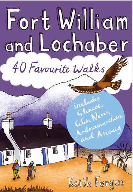

Pocket Mountains - Fort William and Lochaber
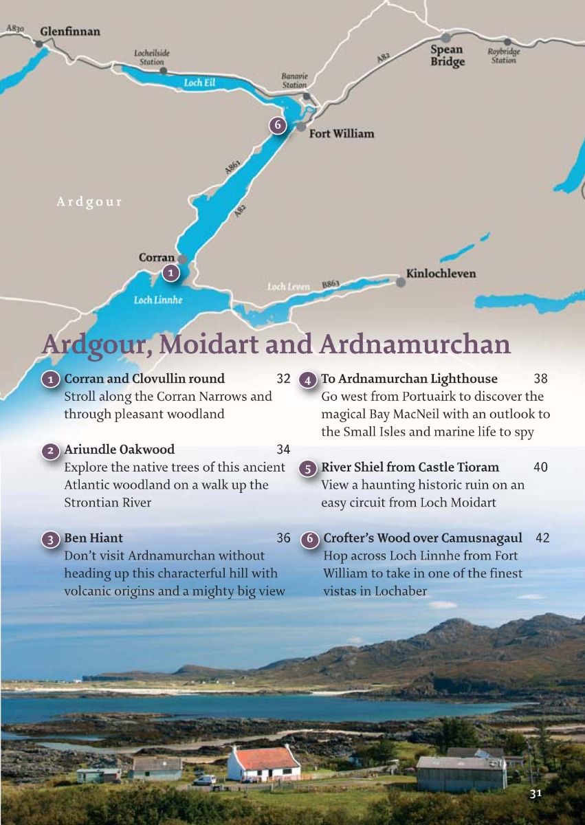
Think of Fort William and Lochaber and mountains will probably spring to mind – lots of them, big ones too, including the biggest of them all, Ben Nevis. The Mamores, Beinn a’ Chrulaiste, Sgorr na Ciche (better known as the Pap of Glencoe) and the iconic Buachaille Etive Mor are just a few of the other peaks that make Lochaber so venerated by hillwalkers and climbers. Yet it offers much more than mountain scenery. The region takes in the wild and spectacular Ardgour and Ardnamurchan Peninsulas, the natural grandeur of Creag Meagaidh, a section of the Great Glen and the magical Rathad an Eilean, the Road to the Isles, which threads its way through the romantic landscape between Fort William and Mallaig.
As it moves around the region, this guidebook takes you on a journey that explores woodland, lochs, waterfalls, canal, moorland and coast, allowing fascinating insights into Lochaber’s history, geology and flora and fauna – as well as some of the finest beaches this side of the Caribbean.
There have been calls for Lochaber to be designated Scotland’s third National Park – in walking across this landscape it would be hard to disagree with this assertion.
History
The history of Lochaber will forever be linked with its most unruly periods – the Jacobite Uprising of 1745 and the Massacre of Glencoe, which took place on 13 February 1692 and saw the vicious slaying of 38 members of the MacDonald clan after they failed to pledge allegiance (many would say rightly so) to King William and his government regime in London.
This atrocity caused outrage in Scotland, becoming a potent symbol of anti-government propaganda, one that would help fuel the fire of Jacobite sympathies and the Uprisings of 1715 and 1745.
The most famous individual involved in the 1745 rebellion was Charles Edward Stuart, better known now as Bonnie Prince Charlie. At Glenfinnan he symbolically raised his royal standard to begin the revolt against the British monarchy that would end in failure on 16 April 1746 at the Battle of Culloden.
Perhaps unsurprisingly given the hostile mountainous terrain, the early influence of humans on Lochaber’s landscape was minimal and there is relatively little evidence of ancient sites – one of the few examples is the Iron Age fort of Dun Deardail above Glen Nevis.
A number of place names in the region have Pictish origins, unusual for the West of Scotland when the influence of the Picts was so much greater in North East Scotland. Lochaber itself means ‘Area of the Loch Confluence’, probably referring to the meeting of Loch Eil and Loch Linnhe, while the Norse influence can also be seen in names like Mallaig and Arisaig. However, the dominant language and culture was Gaelic and the majority of river, loch and mountain designations stem from this poetic tongue.
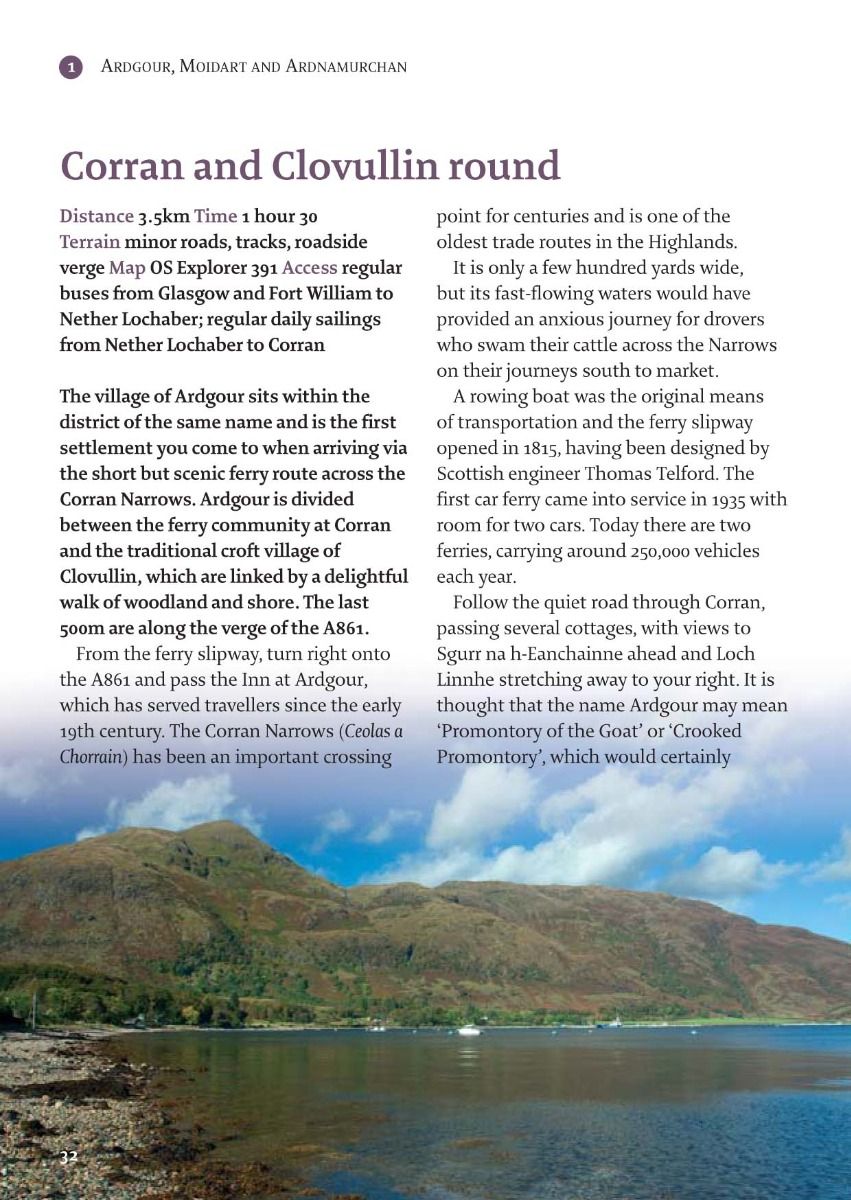
In recent centuries, crofting and fishing have been important in building communities such as Arisaig, Mallaig and many of the tiny settlements along the peninsulas of Ardgour and Ardnamurchan.
Early industry has also had a part to play. The village of Strontian, on the banks of Loch Sunart, developed through mining during the 18th century and the slate quarries at Ballachulish roofed many of Scotland’s buildings while the aluminium smelters at both Fort William and Kinlochleven exploited the local landscape.
Today, Lochaber’s landscape is still central to its popularity and economic success. Low-level and mountain walking are complemented by the long-distance walking routes, the West Highland Way and the Great Glen Way, both of which start or finish within its boundaries.
Cycling, sailing, skiing and wildlife watching are also key outdoor activities and Fort William lies at the heart of the area branded ‘the Outdoor Capital of the UK’. Other villages such as Glencoe, Kinlochleven, Spean Bridge, Kilchoan and Mallaig make excellent bases for exploring different parts of the region.
The natural environment
The geology of Lochaber is what makes it such a compelling place in which to walk. For example, much of the western part of the Ardnamurchan Peninsula was formed through volcanic activity – the ancient ring structures that remain have, in particular, drawn geologists from all over the world.
Much of Glen Nevis and Glen Coe were also formed through volcanic activity about 430 million years ago, shaping their iconic peaks. Lochaber’s landform began
to take shape around this time when the two continents of Laurentia (which now makes up much of Canada) and Avalonia (carrying England and part of Northern Europe) collided to form the Great
Glen Fault.
This extends for 190km from the Moray Firth to the Firth of Lorn at the mouth of Loch Linnhe and contains the deep freshwater lochs of Ness, Oich and Lochy – today all three are linked by the engineering feat of the Caledonian Canal.
Around 20,000 years ago, when Scotland was at its coldest, only the summit of Ben Nevis poked above the ice pack while much of Lochaber remained under an ice sheet until 11,500 years ago when it began to grind the mountains and scour the glens. This weathering and erosion met its match with the more resistant granite peaks of Ben Nevis, the Aonach Eagach Ridge and the Mamores range.
Lochaber also has a number of fjords (better known as sea lochs) characteristic of land that has been subject to glaciation, including Loch Sunart, Loch Nevis and Scotland’s longest sea loch, Loch Linnhe.
All of this points to an outstanding geological heritage that has seen Lochaber designated as one of only three geoparks in Scotland (the other two are the North West Highlands and Shetland Geoparks).
The wildlife and marine life thriving in and around this diverse landscape is second to none and includes golden and white-tailed sea eagle, puffin, storm petrel red deer, otter, bottle-nosed dolphin and minke whale.
Remnants of the ancient Atlantic Oakwood that once covered much of Europe’s west coast can be found in Lochaber and among the varied plantlife that this region sustains are many mosses, lichens and a vast selection of wildflowers.
How to use this guide
Almost all of the walks in this guide can be completed within half a day, leaving plenty of time to explore the natural attractions and historic sites you encounter along the way. Many of the walks are accessible by bus or train, mainly from the Central Belt and from Fort William. Basic public transport information is included in this guide, but details and times can change so please check these before you set out (travelinescotland.com).
The majority of the routes are low-level and take advantage of the excellent network of paths found here. It is not advisable to stray from the routes onto farmland or near exposed cliffs and, where livestock is present, dogs must always be kept on leads.
A few of the routes cross steep hill or mountain terrain where good mapreading and navigation skills are necessary in poor weather. Winter walking brings distinct challenges, particularly the limited daylight hours, whilst strong winds along the coast and over higher ground can occur throughout the year.
Preparation for a walk should begin before you set out, and your choice of route should reflect your fitness, the conditions underfoot and the regional weather forecasts (mwis.org.uk).
Even in summer, warm, waterproof clothing is advisable and footwear that is comfortable and supportive with good grips is a must.
None of the hillwalks or longer routes in this guide should be attempted without the relevant OS map or equivalent at 1:50,000 (or 1:25,000) – and you should know how to navigate using an OS map and compass.
Under the Land Reform (Scotland) Act of 2003, there is a right of public access to the countryside of Scotland for recreational purposes. This right depends on whether it is exercised responsibly, while landowners have an obligation not to unreasonably prevent or deter those seeking access. The responsibilities of the public and land managers are set out in the Scottish Outdoor Access Code (outdooraccess-scotland.com).
| Series | 40 Favourite Walks |
|---|---|
| Brand | Pocket Mountains |
| Continent | Europe |
| Country | Scotland |
Dispatch
We pride ourselves on providing a fast, efficient service and therefore we aim to dispatch all orders received before 4:00pm on the same day.
Free Delivery
We offer a free 1st class delivery service on all orders. This gaurantees you a 1-2 day delivery service via Royal Mail.
Need it fast?
we offer a selection of shipping upgrades at the checkout stage.
- Expedited Shipping - Royal Mail 1st Class: FREE
- Next-Day Courier Shipping - 24hr Courier Service: £6.95
The Dash 14 day – ‘No Questions Asked’ Returns Policy
Provided you return the item(s) to us in an unused and resaleable condition along with its original packaging…
We guarantee that if you change your mind for any reason within 14 days of purchase, you are free to return your item(s) to us for exchange or full refund on the product price
Beyond our 'No Questions Asked' period we will of course, happily accept items being returned as a result of damage or packing errors. In each of these cases we will provide you with a freepost address for the return of the item(s).